Search
Featured Programs


 News


 24/08/2026 16:07
 Editor:
Tomasz Koper


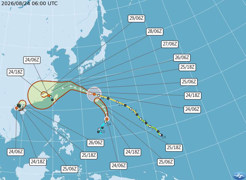
The Central Weather Administration (CWA) said on Monday, August 24, that a maritime warning for Typhoon Saudel may be issued as early as Wednesday, August 26.
Taiwan has been experiencing heavy rainfall brought by southwesterly winds and a low pressure belt. Additionally, a tropical depression TD24 began moving northward in the Taiwan Strait. As a result, Kaohsiung, Pingtung, and Tainan saw between 800 and 900 millimetres of rain, while Chiayi, Hualien, and Taitung recorded 400 to 500 millimeters.
Meteorologist Wang Pin-hsiang (王品翔) said another typhoon, Atsani, formed over the waters east of the Philippines. It may move north-northwest and eventually merge with Saudel. As a result, Saudel is currently considered likely to pose a threat to Taiwan.
Saudel is now around 1,500 kilometers from Taiwan. Wang said: “It currently appears to be a moderate typhoon. It is expected to possibly reach the upper limit of a moderate typhoon, which is roughly its current intensity, and move west-northwestward through the Ryukyu Islands. Around Thursday or Friday, it may turn west-southwestward and approach the waters north of Taiwan. A marine typhoon warning could potentially be issued early on Wednesday.”







 /